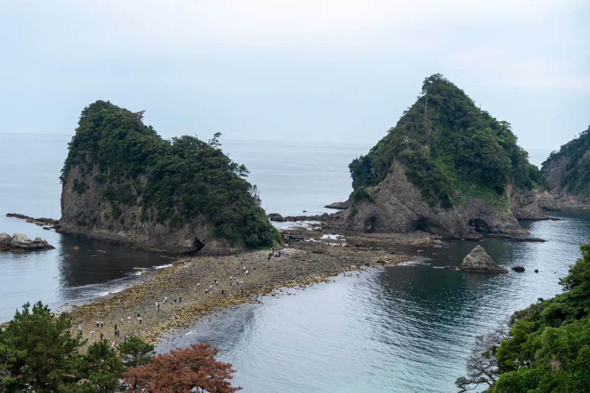
The Tombolo Land Bridge is a rather interesting feature along the Dogashima coast in Nishi-Izu. It’s a pathway leading to an island, only accessible at low tide. At other times, it’s just a random island off the coast and it doesn’t look crossable at all.

When we visited at the end of May, there was a crossable time around 11am on a Sunday. Although much of the places we explored in Izu had been pretty sleepy, there were a lot of people checking out the Tombolo - probably thanks to the good timing.

It seems the island here is called Zo Island (elephant island). Which apparently is because it looks like an elephant drinking out of the ocean. I don’t really see it? What I did find funny is that we passed two separate groups of people that had the same conversation - that it looks like the nostrils on someone’s nose.
Even more excitingly, I spotted my 7th new bird on this trip here. A Pacific reef heron, which basically looks like a dark mode version of an egret.


The moment I saw it, it was a quick fumble to get out my telephoto lens. I’m glad I hurried, because a passing kayaker scared it away pretty quickly. I eventually saw it again, fishing on the other side of the island.

We sat down on some rocks and enjoyed our lunch here. There were plenty of families investigating all the little rock pools around the island. Quite cutely there was a sign at the entrance of the land bridge telling people to return any sea creatures they picked up - and to please come visit them again next time.

Before leaving, I took another photo of the bridge to see if I could see any changes in the before-after in terms of the tide receding (we were there for about 50 minutes).

Really you can barely tell the difference, but the one thing I noticed was that the exact same man with the blue shirt had been sitting on that log for the entire time.
For fans of the anime Yuru Camp, it seems the girls made a visit to the Tombolo.

It makes it look rather cool when they cross it when the path is barely there (not sure what happens in the anime - if they accidentally left it too late or what).

As a side note, this landmark is literally called the “Tombolo Land Bridge” on Google Maps, but this is actually quite a generic name. A “tombolo” is just the word for this specific land bridge phenomenon, and there are many of them across the world. Even Mont-Saint-Michel sits on a tombolo. The Japanese name for this feature is “Dogashima’s Tombolo” which feels more accurate.
When to visit the Tombolo Land Bridge
Handily, the Nishi-Izu government provides a website with a PDF marking the low tide times. Scroll down to the link marked “潮見表”, and you will be looking for the rows marked in pink on the PDF.
As for the carpark, the carpark right outside the land bridge is large, but has a rather exorbitant 1000 yen parking fee. You can try your luck with this free parking lot a little further up the road.
Leave a comment