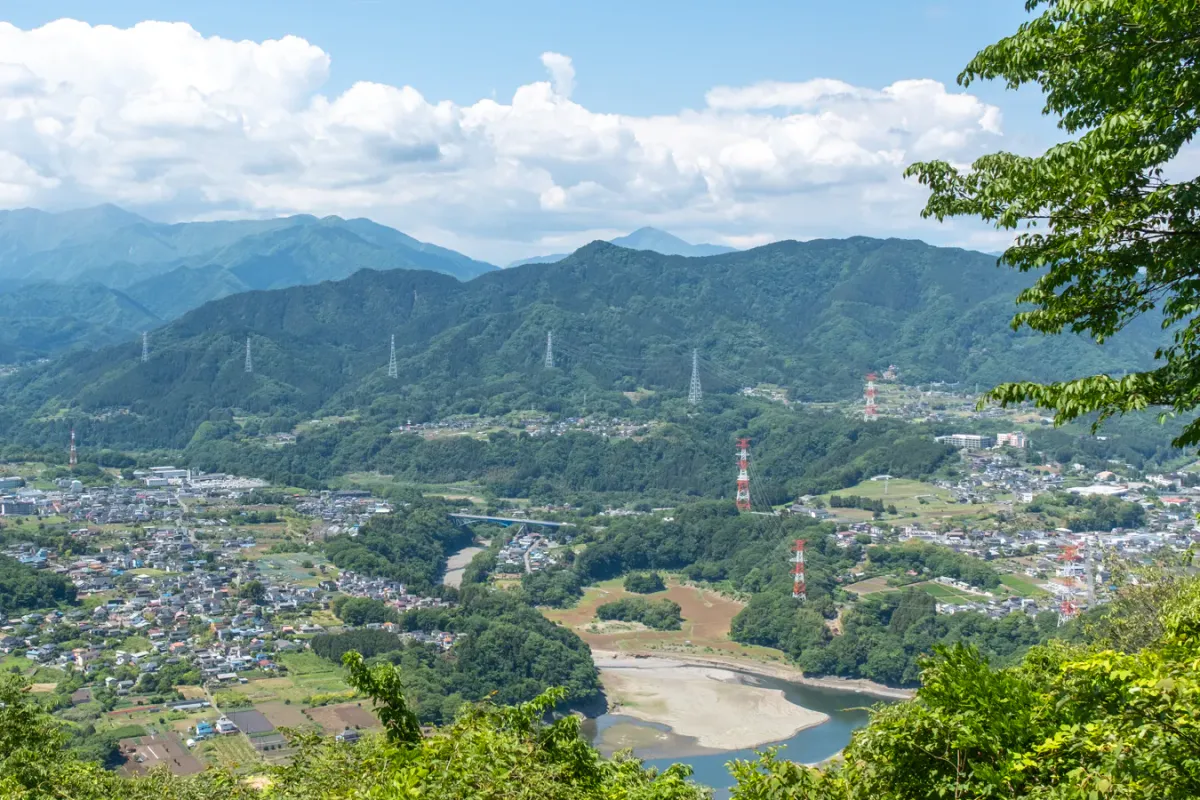
The Minami-Takao loop hike starts and ends at Takaosanguchi station, and is a good alternative to a regular Mt Takao hike if you are looking to get a longer hike in with less crowds. It is a hike mostly in the forest without many views, so in an attempt to spruce up its image the course has also been given the name “Seven Summits”.
To be honest though, I will say that if you are new to hiking in the Takao area and are looking for a longer hike, I would first recommend doing the Mt Jinba to Mt Takao traverse hike as this comes with some great Mt Fuji views and is generally more fun. Since I’d already climbed Mt Jinba this year though, and I was looking to start doing longer hikes in preparation for the upcoming summer hiking season, this was the perfect hike for me considering how close to Tokyo it is.
Hiking Minami Takao: a quick summary
55mins from Shinjuku to Takaosanguchi station on the Keio line.
- Minami-Takao Seven SummitshardTrain7.75 hrs·15 km·↑ 1162m
The other cute thing about this hike is that the trail you follow makes a heart shape (if you squint) which is another selling point for people who upload their hikes on hiking social media like YAMAP.

The hike starts at Takaosanguchi station, the same as if you are going to be climbing Mt Takao. It was going to be quite a warm day, so I got an early train out of Tokyo, and arrived at around 8am to begin my hike.

The first part of the course is a little suspicious and it’s hard to know whether you are on the right track - Mt Takao is very well-signposted, but this course not so much.


Once you climb up a bit, you’ll end up on a fairly normal, forested trail with lots of ups and downs. Over the 15km hike, you’ll pass by a total of seven summits, as the course name would suggest, and then finally pass by Mt Takao, and descend back down to the station.

Note that Mt Takao is not one of the 7 summits! This is my second time hiking this course, and last time I only managed to spot 6 of the peak markers. This time I had an even worse go of it and only managed to find 5 (oops). Luckily combined across both hikes, I’ve managed to see all 7 so I’ll count that as a win.

The very first peak you’ll reach is Mt Kusato (草戸山, elevation 354m) which is very hard to miss as it comes with a small shrine and torii gate.


The second peak is Mt Enokubo (榎窪山, 420m) which I managed to miss this time, as the peak marker is not quite obvious.

Beyond this point the trail diverges a number of times, with left and right forks available. Generally one path might climb up-and-over a small hill of some sort, while the other path skips the climb and then goes around, but generally both merge up again and head in the same direction in the end. The tricky thing is that some of the climbs also include one of the 7 peaks, so you don’t want to miss those (if you care about that).


There is also a stone marker marking that we are on the Kanto Fureai trail - an 1800km trail that is split out into smaller sections (it is not continuous). Today I was walking part of the “湖のみち” trail.


To keep things interesting, there are also some wood-carvings on the trail, like this one of an owl.


The third peak Mt Taikouji (泰光寺山, 475m) is one of those that is easily-missed, as you’ll need to take a detour climb up.


Descending past this peak, you’ll reach a rest area with another wood-carving, this time a huge dragon bench. Helpfully, there’s a smartphone stand you can prop your phone on if you wanted to take a photo together with it.


In an attempt to make sure I didn’t miss any peaks, this time I managed to accidentally get an extra peak - Mt Higashi (東山, 460m) - which isn’t even one of the seven.

In quick succession, you’ll also pass by the next peak, Mt Irisawa (入沢山, 490m) which is my favourite of the 7 peaks because it comes with a sign that says “restaurant in the sky” (天空レストラン) and for some reason has an illustration of some wine and cheese.


Beyond this is the only point of the course where you can get a rather nice view - and a glimpse of the tip of Mt Fuji if you get lucky with the weather.


I didn’t have any such luck with that today, but here’s a photo from the same spot I took in 2023, where you can just see the tip of it peeking out.

Next up is Mt Nakazawa (中沢山, 494m), which is located together with a stone statue of a Kannon Bosatsu. I managed to miss the peak marker this time, though.


The second-to-last peak is Mt Konpira (金毘羅山, 515m).
There had been these rather mysterious wooden dangling poles at various points along the hike, and I was a bit confused what the point of them was (some sort of weird art installation?)

But here quite helpfully it says リュック掛 - a place to hang your bags, if you didn’t want to get the bottom of them dirty.

After reaching Mt Konpira, I was about halfway done with the hike, and I was starting to feel rather tired. I distinctly remember feeling that same feeling at this exact point the last time I hiked this course, so maybe this is the point where all the successive climbs-and-descents get to you.
Before I knew it though, I reached the next and last of the 7 peaks, Mt Oobora (大洞山, 536m). You’ll also notice that each of the peaks on this course have gradually been at higher elevations, so maybe this is by design (there was another peak or two not too far off the course that you skip, so maybe they got excluded for that reason).

From here you’ll descend to cross a bridge across a road, and then head towards Mt Takao.


Although I had been a bit worried about the warm weather, actually with how shaded this course was, plus with a nice cool breeze, it had been a rather comfortable hike up until this point. It’s only this last stretch here where you lose the shade, as you head up on a dirt path through a grass field.


Although I had felt quite tired for a bit previously, I was in pretty good spirits at this point! There were quite a few huge black butterflies flitting about, and I could hear so many different bird species in the trees. Unfortunately I didn’t really get a chance to take a photo of either (those butterflies refused to sit still for me).

Eventually you’ll come to a viewpoint with another chance to get a view of Mt Fuji. The course now intersects with hikers coming from Mt Jinba or Mt Kotoboke, so you’ll probably start to see a big uptick in hikers at this point. For as busy as Mt Takao itself can get, the Minami-Takao course in comparison is far less crowded - I saw under 10 people in my first 3 hours of hiking.


Beyond this point the trail is very familiar to me, having climbed Mt Takao and/or Mt Jinba many times before. Although there is still a fair bit of climbing with the stairs, it feels good knowing the end is in sight.

Finally I got to the peak of Mt Takao, and even though it was a weekday it was super-crowded with hikers, especially lots of school children on an excursion. It probably didn’t help that it was right on 12pm so it was full of people enjoying their lunch.

Next it was a long descent down the No 1 trail - the road makes it feel a bit rough on the knees, so maybe you could take an alternative course down, but I’m not sure if that would impact how cute the heart-shape of the course will turn out afterwards.


The Banksy of Takao had a new display up this week - one for Mother’s day, which had been just the weekend before.


And before I knew it, I was back at Takaosanguchi station!
I’ve only been doing shorter hikes this year, and I’ve been conscious of the fact that I need to start doing longer ones to make sure I can handle some harder hiking in the summer - so this one’s pretty perfect for that.
Hiking course options
A loop hike starting and ending at Takaosanguchi station, passing through the seven summits of Minami-Takao before climbing up to Mt Takao and then descending via the No 1 trail.
Public transport access
The hike starts at Takaosanguchi station - make sure not to get this confused with Takao station, which is a different stop.
The hike ends back at Takaosanguchi station, so you’ll get back home the same way. Trains are very frequent on the Keio line so you will only have to wait up to 10 minutes for the next train back.
Car access details
There is some parking at Takaosanguchi station, but expect to pay up to 2000 yen for a day’s parking. Definitely one I’d recommend coming by public transport if you can.
When to hike the Minami-Takao course
Due to its low elevation, Mt Takao and this Seven Summits course can be hiked nearly year-round without snow. Tokyo tends to get a couple of days of light snow a year, so if it snowed in Tokyo, you can expect there to be some snow on Mt Takao as well, but otherwise you should be fine.
However since it is so low elevation, and summers in Japan get really hot, I would try and aim for the spring / autumn / winter seasons if you can. If you’re hoping to get a view of Mt Fuji, you should also target the colder months, as the chances of seeing Mt Fuji are much higher in winter.

Read more
See other hikes nearby
Comments
Very funny find!
Yeah he's been doing it for quite a few years now at least, there's a news article about it here!
Leave a comment