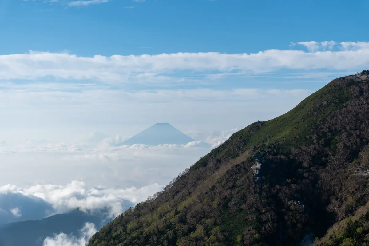
Japan has some great hikes in the Japanese Alps, and the summer hiking season for these 3000m+ peaks generally kicks off in mid-July (depending on the mountain) each year. For those that might be visiting Japan in May or June you might be left wondering, what should I climb? Unfortunately since the tallest peaks will still have a decent amount of snow on them, I can’t really recommend hiking them unless you have the proper gear and experience. Luckily Japan has thousands of mountains so there are still plenty more you can enjoy, regardless of the season.
There are way more mountains you can hike than the ones I specifically listed on this page, but I specifically tried to pick ones that I think have the best views, and get closest to providing that “wow” factor that you might get out of an Alps hike. If you wanted to jump to a specific mountain:


I’ve made sure that all the mountains on this list are hikeable in June. In some cases, some of them some of them I’ve marked as being hikeable from mid or late May, but you may be able to do an early May hike, depending on the mountain. It really depends on the temperatures that year as to when the snow will completely melt - so if you are willing to do a bit of research beforehand on YAMAP you will be able to figure out exactly what trails are safe to hike.
If you’re looking for more hiking recommendations, you can also see my full guide to the best hikes in Japan by month.
Is May and June a good time to hike in Japan?
May is still a pretty good time to hike mountains in Japan up to the 2000m elevation mark - there may be some warmer days, but overall it’s not blisteringly hot yet so you can still enjoy a nice hike. However honestly speaking, June is not too great of a time for hiking as the rainy season, or “tsuyu” begins on average in mid-June each year in Tokyo and continues for a month until mid-July. During this time the chance of rain can be quite high, making it much harder to plan a hike. If you’re further south, like in Kyushu, the rainy season will start earlier in late May but then end a little bit earlier than tsuyu in Tokyo.
Of course, it’s not impossible to hike in June! There are still sunny days, but you will need to keep some amount of flexibility in your plans. e.g. instead of planning to hike a specific mountain on a specific date, I would give yourself a least a couple of days buffer and keep a couple of different mountains in mind. So if the weather conditions aren’t looking too good on one mountain you can swap plans to another. It might surprise you to know that even for mountains within a couple of hours of each other, the weather conditions can vary quite a bit - it might be a bit rainy on one peak, but not at all on another.
Do Japanese mountains still have snow in May and June?
Yep! Plenty of mountains in the 2000m - 3000m range will still have snow. For hiking snowy mountains, it is recommended that bring proper snow equipment like crampons (spikes you put over your hiking shoes for better traction) and an ice axe.
If you are planning on hiking a mountain where you aren’t sure whether or not there may be snow, you can use the hiking app YAMAP, which many Japanese hikers use. Once you find the trail you are planning to hike, you can start to research recent trail logs and scroll through the photos to see if there’s any snow remaining. Note that even though all the snow on Mt Fuji (the tallest mountain in Japan) melts by the beginning of July, other mountains can actually still have snow remaining even until mid-July, so it pays to double-check.
Mt Yake: a day hike from Kamikochi (2455m)

Mt Yake and Kamikochi
The Northern Alps is home to some of Japan’s prettiest mountains, and Kamikochi in particular is known as the gateway to the Northern Alps. From here there are multiple hiking courses out to many of the peaks in the Alps, usually taking hikers 2 - 3 days to climb.
The easiest peak to climb from Kamikochi is Mt Yake, which can be done as a 7 - 8 hour day hike from June.
If you are coming in May it will be a bit too early for Mt Yake, but Kamikochi itself is a popular tourist destination - it’s really scenic, with views up to the mountain peaks above and a wide river threading through the valley. There is a short 2 - 3 hour hiking course to do in the area too, which makes for a pretty reasonable option if you are coming as a day trip.

Since it takes so long to get to from Tokyo, it may be worth spending a night in the area to make the most of it, although I’m sure accommodation can get quite expensive. If you have your own tent Kamikochi does also have a campsite which can make for a good basecamp before you head off to climb Mt Yake.
Getting there
From Shinjuku you can get a direct bus to Kamikochi in about 5 hours. Alternately, you can also get on a night bus at 10:30pm, and it will drop you off at Kamikochi at 5:20am where you can begin your hike uup Mt Yake straightaway. Kamikochi is also accessible via Matsumoto station, from where you’ll need to get a local train, and then a bus to Kamikochi.
For those coming by car, Kamikochi itself is closed off to cars for environmental reasons, so you will have to park in a carpark about 30 minutes away and get a shuttle bus in.
Mt Chausu: a volcanic day hike in Tochigi (1915m)

Mt Chausu
Mt Chausu is a great volcanic hike up in Tochigi. Since it’s a volcano, it has a very harsh yet beautiful scenery that you don’t see in a lot of other Japanese mountains - there’s absolutely no trees, so you just get a long view of exposed, orange-looking ridge lines for your entire hike. I’ve hiked this one at the end of May, which felt like the perfect time to go. With a ropeway taking you to near the summit, you can do the hike in as little as 1.5 hours and 2km, or extend your hike with longer courses as well.
Getting there
It’s about 2.5 hours total travel time from Tokyo to the trailhead, which includes taking a shinkansen to Nasushiobara Station, and then a bus to the ropeway station. The Shinkansen can be a little pricey (6000+ yen one way) so if you wanted to save money you can wake up earlier and take a local train (it will take double the time, but cost around 2600 yen instead).
The buses to the trailhead run from the beginning of April through to the end of November. However there will still be snow remaining in April. By early May most of it will have completely melted, so it may be worth double-checking the trail photos on YAMAP to see the conditions if you are planning an early May hike.
Mt Asama: an active volcano near Karuizawa (2568m)

Mt Asama
Mt Asama is an active volcano near the resort town of Karuizawa. Mt Asama only reopened at the end of May this year, as its volcanic activity dropped to a “Level 1” and became safe to climb. Before that, it was closed for a couple of years - so if you have any interest in hiking this one, it’s probably best to get in quick before it closes off again.
Mt Asama is such a picturesque mountain, although can be a bit of a tough one, as the hike will take you 9 hours. If you’re not interested in such a long hike, you could also just do a shorter hike to Mt Kurofu, as you can get some great views even from there.
Mt Asama can be hiked from around mid-May. In early May it seems like there will still be some traces of snow remaining, but quite possibly hikeable, so you will need to check the conditions on YAMAP.
Getting there
Access to Mt Asama is first via a train to Sakudaira station (2 hours by Shinkansen from Tokyo) and then a bus to the Takamine Kogen Hotel (1 hour). Note that if you are coming via public transport, a day hike is not really feasible. Luckily there is a hotel right at the bus stop, so you can stay there the night before and have a more relaxed start the next day.
If you are coming via car, there is a carpark available next to the bus stop as well - a 3 hour drive from Tokyo.
Mt Hinata: the Southern Alps’ beach in the sky (1660m)

Mt Hinata
As well as the Northern Alps, Japan has another mountain range known as the Southern Alps. Most of the mountains here are also quite high-elevation and not possible to climb in May - June, but one lesser-known option is Mt Hinata. At only 1660m it’s a tiny peak compared to its giant neighbours, but comes with some great views of the nearby Mt Kaikoma and the Yatsugatake mountain range. Not to mention the summit is completely covered in sand, like a beach! You can climb it in both May and June.
Getting there
If you are coming from mid-June, there is a mountain taxi running to the trailhead from Kobuchizawa station (小淵沢駅), at an affordable 1800 yen one-way. You will need to book this in advance, but I would recommend using this to get to the trailhead.
Alternatively there are buses running, but they drop you off a 50-minute walk from the trailhead so it will turn what is a 5 hour hike into a 6 - 7 hour one.
For those coming by car, there is a carpark directly at the trailhead about a 2.5h drive from Tokyo.
Mt Houou: an overnight hike in the Southern Alps (2841m)

Mt Houou
Still staying in the Southern Alps, and the first overnight hike on this list, is Mt Houou. Although it sits at an elevation of 2841m, its climbing season starts a little earlier than some of its 3000m+ Southern Alps neighbours, and so you can climb this one from late May. From near the peak you can get some great views out to the other peaks in the Southern Alps, plus even views of Mt Fuji if the skies are clear. Mt Houou can be done as a long, 12-hour day hike for those with the endurance, but is probably best done as an overnight hike with a stay at the mountain hut halfway up the mountain.
Getting there
Mt Houou has 4 separate trailheads - so there are plenty of public transport options depending on what you want to hike. Buses depart from Kofu station, and it’s about 3.5 - 4 hours to get to the trailhead from Tokyo. There are also carparks if you want to come via car, which will be a 3 hour drive from Tokyo.
Mt Zao: a day hike to the Okama crater (1841m)

Mt Zao
Mt Zao is famous for its stunning green Okama crater lake, and is also well-known as an onsen town and ski resort in winter. With a Shinkansen it’s accessible as a day trip (albeit pricey) from Tokyo and can be hiked from late May. A ropeway will take you most of the way up, and the course is 4 hours, so it’s pretty beginner-friendly too.
It’s a little far from Tokyo though, so while you’re there I would recommend making the most of a weekend and enjoying the sights in Sendai. Some local “meibutsu” (or famous food) of Sendai would have to be the edamame-flavoured zunda milkshake (I am obsessed with these) plus the beef tongue “gyutan”.
Getting there
From Tokyo you’ll first take a Shinkansen to Yamagata station, a bus to the Zao Onsen bus terminal, and then finally the ropeway up to the start of the hiking trail. All-in-all it will be 4 - 5 hours of travel time before you can start hiking.
If you are coming via car, you can skip the ropeway, and instead park at the other end of the hiking course, which has a carpark.
Mt Aka: the highest peak in the Yatsugadake mountain range (2899m)

Mt Aka
Mt Akadake is an absolutely gorgeous mountain. I love the view you can get of its imposing peak, and the Yatsugadake mountain range is a little closer to Tokyo than the Northern Alps so it’s fairly accessible as well. You can do an out-and-back to the peak as a 7-hour day hike if you come by car. The bus stop is further away from the carpark, so for public transport users the shortest hiking course will take you 9 hours.
If you want to do a loop of some of the major peaks in the range, there is a longer loop course that will take you 2 days, and it’s a great opportunity to spend a night at one of the mountain huts along the way.
Getting there
Mt Aka can be accessed via an overnight bus directly to the trailhead (from Keio-Hachioji station) which will drop you off at the trailhead at 5am.
Alternatively, you can get a local bus from Chino station to the trailhead. With an overnight bus, you can do this as a day hike. If you are looking to do one of the longer trails, you could start your hike later in the day and turn it into a 2-day hike.
For those coming by car, there is a carpark available at the trailhead. Note that the final 2.5km is along a rough dirt road, and on weekends the carpark can fill up - so it may be worth driving up before it gets dark the day before to snag your spot if you are wanting to do this as a day hike.
Mt Aso: the largest active volcano in Japan (1592m)

Mt Aso
Another underrated option for hiking in Japan is to head down to the Kyushu region, which has a lot of great day hikes at comparatively lower elevations
Mt Aso is the largest active volcano in Japan. Its most iconic feature is the Nakadake crater, which billows out clouds of white smoke. From the crater, you can hike through a Mars-like landscape up to Mt Aso’s highest peak, Mt Taka-dake. As Mt Aso is such an active volcano, depending on its activity level it can be closed off to visitors, so I recommend double-checking before you go. One particular highlight of Mt Aso is in late May, when the pink Kyushu azalea bloom.
However note that the rainy season kicks off in Kyushu in mid to late May each year, which can make it a little harder to plan your hike!
Getting there
Mt Aso is accessible via a shuttle bus from Aso station, which leaves the station at 9:55.
You can access Aso station via the JR Line. If you are coming from Kumamoto, expect it to take 80 - 90 minutes by train (you may need to transfer once) on the JR line. When I hiked, I found that a lot of people arrived at Aso station at 9:45 in time for the shuttle bus - so I would recommend either speedily getting off the train, or even getting an earlier one if that is an option, to be sure to get a spot on the shuttle bus (it can be quite a while to wait for the next one).
Mt Kuju: yet another volcano (1787m)

Mt Kuju
You might start to notice a theme with many of the hikes I’ve mentioned on this page - I kind of love volcanic mountains. They come with some really nice scenery, but are often at lower elevations so I feel like you can get some of that “wow” factor on your hike without having to wait until it’s truly summer to head to the Alps. Mt Kuju is one of my favourites down in Kyushu.
It can be done as a day hike, but there’s a total of 17 peaks in the Kuju mountain range so you can turn it into an overnight hike as well. As well as hitting Mt Kuju, for the peak-baggers it may be worth the short detour to Mt Nakadake which is the highest peak in mainland Kyushu.
Getting there
There’s a limousine bus service that conveniently passes by both the Kuju trailhead and the Makinoto-toge trailhead on the way towards Kumamoto, which makes this hike pretty accessible via public transport.
There’s a couple of different trailheads, and I think most if not all of them will have car access as well if you are driving.
Kaimondake: a mini Mt Fuji in Kagoshima (924m)

Kaimondake
Kaimondake is a little conical peak that sits right at the bottom of Kagoshima prefecture. From the top of this mountain you get great views of the sea and up the coast of Kagoshima prefecture. What makes this one unique is that oftentimes with a mountain you might just do a straight zigzagging climb up to the peak of it, but in this case you do a spiral loop around the whole mountain.
Getting there
To begin your hike, you can get a local train out of Kagoshima to Kaimon station, which is about a 25 minute walk from the trailhead. It’s surprisingly accessible for a mountain in a rural town, although the number of trains are few - so you can take your time and enjoy your hike. From memory there was no convenience stores in the area, and just one random local ramen shop that was open, so it may be worth bringing extra snacks.
Kaimondake is also accessible via car - from memory there is a carpark near the trailhead.
Mt Miyanoura: traversing Yakushima island (1936m)

Mt Miyanoura
If you are looking for a longer, wilder hike, I would recommend taking a ferry or plane to the island of Yakushima, which is home to Mt Miyanoura, and the forest said to be the inspiration for the Ghibli movie Princess Mononoke. At 1936m it’s the tallest mountain in Kyushu, and I did it as a 3-day traverse staying at unmanned huts on the trail, timed to catch the pink rhododendron flowers that bloom towards the end of May.
Getting there
Getting to the island is a bit of a pain - you can either get a ferry or plane from Kagoshima. We were able to fly from Tokyo to Kagoshima, and then from Kagoshima to Yakushima. There are local busses running around the island which can take you to and from the trailhead.
It is also possible to rent a car from just outside the airport, if you owuld like to do an out-and-back trail from one of the trailheads.
Looking for more hikes?
I picked out a bunch of mountains which I think offer the best views if you are wanting to hike in May - June. For some more hikes, you can check out 42 of my favourites in my guide to the best hikes in Japan by month, or browse all of my hiking reports on my main hiking in Japan page.
Happy hiking!

Read more
Leave a comment