Mt Tonodake (塔ノ岳, tono-dake) is one of the most popular peaks in the Tanzawa mountain range. Its location in Kanagawa prefecture also makes it a great mountain to grab a view of Mt Fuji if the weather conditions are good.
I’ve climbed Mt Tonodake a number of times, but always via the Okura (大倉) trailhead. It’s well-known as a gruelling 3-hour climb of mostly stairs that has been affectionately termed the “baka-one” (バカ尾根) or “stupid ridge” by locals. For my first hike of 2025, I decided to hike it instead from Yabitsu Pass (ヤビツ峠, yabitsu-toge), which I’ve often heard is the more interesting trail. And it did not disappoint!
⛰️ If you are interested in climbing from the Okura trailhead, I’ve previously covered it in my Mt Tanzawa post.
Hiking Mt Tonodake: a quick summary
About 70min from Shinjuku to Hadano station by train (Odakyu line), then a 50min bus to Yabitsu-toge (bus stop #4, route 秦21)
- Yabitsu-toge → Mt Tonodake → OkurahardTrain + Bus8 hrs·15 km·↑ 1160m
- Okura → Mt Tonodake (out-and-back)hardTrain + Bus7 hrs·14 km·↑ 1200m

After getting on a very crowded bus from Hadano station, and enduring the ride up the long windy mountain road to the trailhead, we started our hike just after 8am. For a cold January morning, I wasn’t expecting there to be so many hikers but it was quite busy.


The first 20 minutes of the trail takes you down a regular road before you reach the real trailhead. We did have one taxi with hikers in it pass us by. Probably expensive, but a nice way to cut some distance off your hike.

Having heard such good things about Yabitsu-toge, I was a little bit disappointed at first. “This feels just like Okura! Why are there so many stairs!”

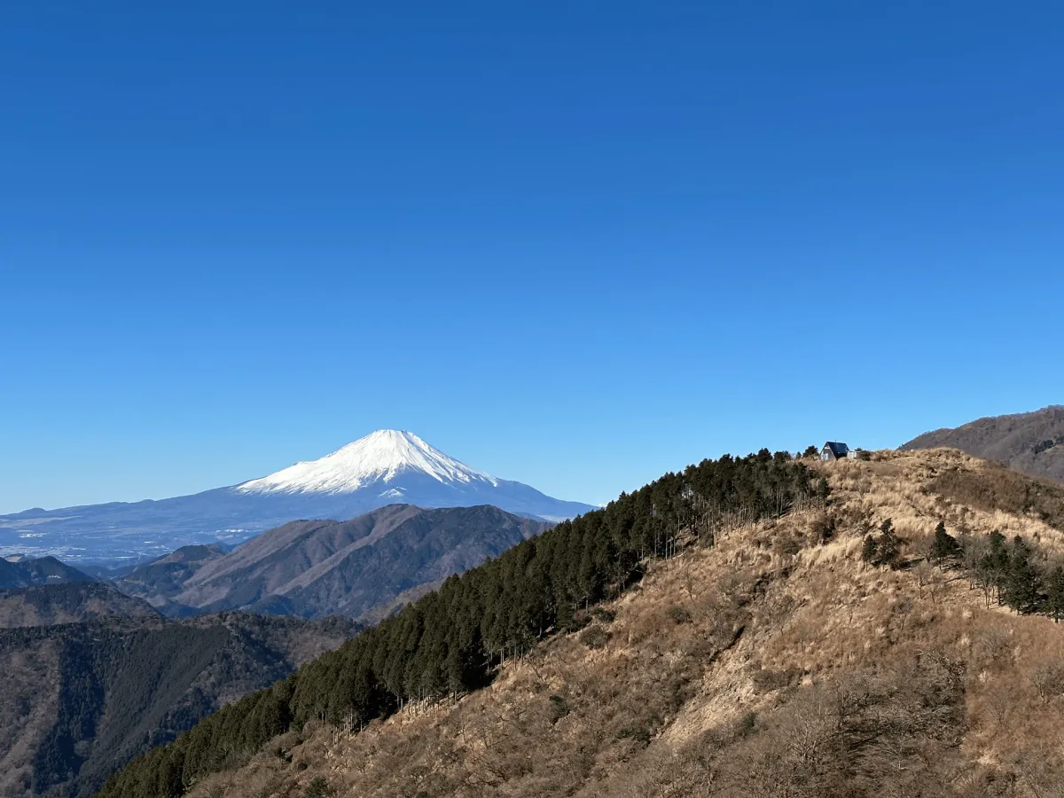
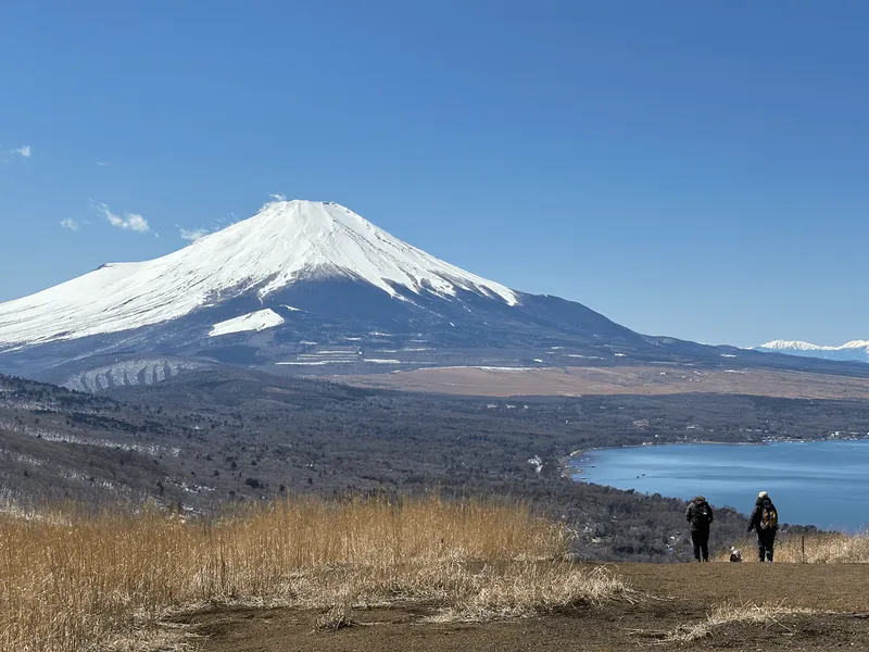
But by 9:30 we reached our first peak of Mt Ninoto (二ノ塔) and got our first glimpse of Mt Fuji - some great views.


From here, it was back to more climbing, and more stairs. After a short while, you’ll pass the next peak of Mt Sannoto (三ノ塔). Mt Sannoto’s “san” (三) means three, and Mt Ninoto’s “ni” (二) means two - which makes you wonder, where is the first peak, Mt Ichinoto? Apparently it’s at a place called Karako shrine. The story goes, a long time ago some villagers saw three “sacred lights” in the night sky. At the first place, they built the shrine, and then the second and third places they named “ni” and “san”-noto.


It seems like Shugendo practitioners were also initially the ones using the mountain trails in the Tanzawa area. Nara’s Mt Omine and Shikoku’s Mt Ishizuchi are quite famous for being religious training grounds, but I didn’t realise their influence came up this far north. I’d never really thought about who hiked all of Japan’s mountains first. I’d be curious to know what percentage were due to religious reasons.

But anyway, back to the hike. From Mt Sannoto you get an even better view of Mt Fuji, and in the distance you can even see the tiny dot that is the mountain hut at Mt Tonodake’s peak.


After reaching Mt Sannoto, I can really start to see the Yabitsu-toge trail’s appeal. You get this long exposed ridgeline walk, with views out to Mt Fuji in the distance. You do have some up-and-down portions, but the view more than makes up for it.


Unlike Okura, which is nearly all stairs, the Yabitsu-toge trail does have two small chain descent sections. As always, it’s hard to convey in a photo (it feels scarier in person) but overall I’d say this was on the milder side.


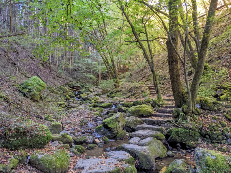
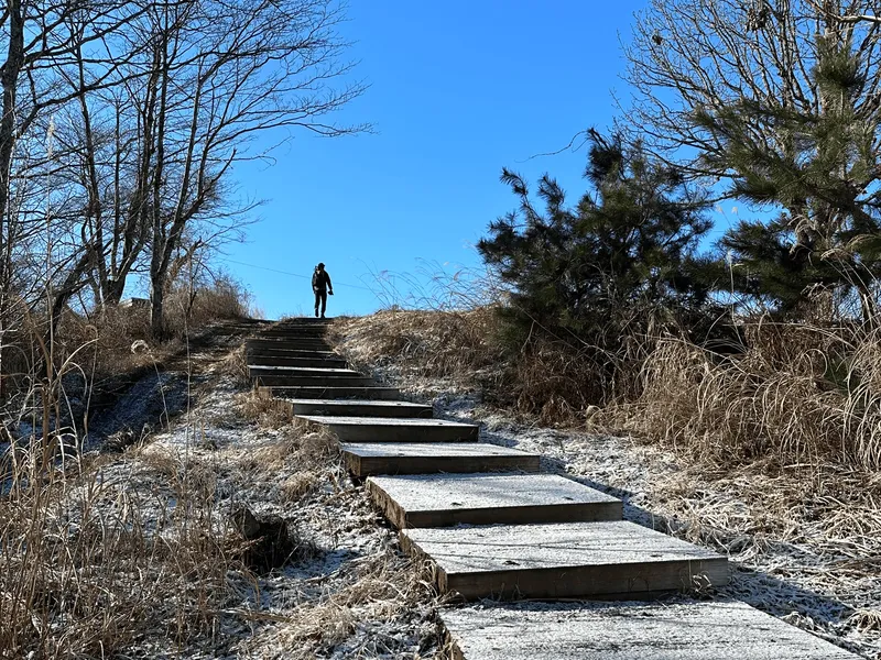
Another characteristic of the hiking trails in the Tanzawa area is that there are a lot of wooden stairs and boardwalks. So although the trail up to Mt Tonodake can be long, they really help make for a more comfortable hike.

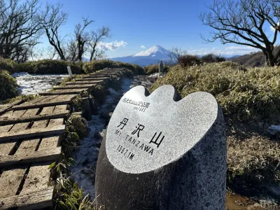
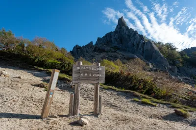
A little before 12:30, we reached the peak of Mt Tonodake (塔ノ岳). As far as peak markers go, it’s quite hefty one - probably close to 3m in height.

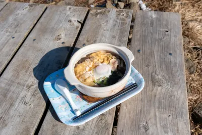
There are at least 4 different trails that converge on this summit (from Mt Nabewari, Mt Tanzawa, Okura and Yabitsu-toge) so it’s always a pretty busy interchange with lots of hikers. But it’s also a super wide area, so it doesn’t feel like the overwhelming crowds you sometimes get on other summits. There’s a mountain hut here too where you can warm up, if you don’t mind paying 500 yen for a cup of coffee.

Once we had our lunch break, it was time to descend towards the Okura bus stop. This was a very familiar course for me - it was at least my 5th time descending down it. It’s a long descent, and it definitely feels like it.


You’ll also pass the burned remains of the 堀山の家 mountain hut, which burned down on the 11th of January 2026.

Today we finished our hike by about 3:15pm, with plenty of daylight to spare. In winter, it gets dark by 5pm so I would be careful to finish your hike before then.


We got the bus back to Shibusawa station. Before heading home, we stopped off at the train station’s Mister Donut store for some coffee and a well-earned donut (or three).
Hiking course options
The photos in this blog post covers the hike to Mt Tonodake from Yabitsu-toge. It’s the more varied and scenic of the course options, and would be the one I would recommend.
The one downside is that the bus trip to Yabitsu-toge takes longer, and you will probably want to commit to hiking the full thing since the buses back from Yabitsu are less frequent if you decide you want to bail part-way up.
Doing an out-and-back from Okura is a little more boring as there are a lot of stairs - I have this route covered on my Mt Tanzawa post. You still get great views of Mt Fuji though! The upside is that it’s more convenient to get to the trailhead, and you can bail out on the hike mid-way up if you find you are not really feeling up to the challenge of climbing all the way to Mt Tonodake.
There are toilets and mountain huts at a number of points along both trails. Whichever course you choose, you’ll descend via Okura since it has the better bus access for the return.
Public transport access
From Shinjuku, take the Odakyu line to Hadano station, which will take about 70 minutes. If you are coming from somewhere else in Tokyo, you will need to transfer at Shinjuku station as that is the first stop on the line.
From Hadano station, you’ll head out the north exit, then you’ll be looking to take the 秦21 bus from the #4 bus stop to the end of the line at Yabitsu-toge (ヤビツ峠). To be honest, it will probably be super-crowded with hikers so you will immediately know where to line up.
The lines for the bus when we hiked at the beginning of January were immensely long, but they put on about 3 extra buses to try and clear up the crowd, so I think at worst, you’ll have to wait for the second scheduled bus.
As an example itinerary:
- Get on the 6am train from Shinjuku station
- Arrive at Hadano station a bit after 7am, and get on the 7:20 bus
- Arrive at the trailhead at 08:08
Alternatively, if you want to take the out-and-back route you will want to first go to Shibusawa station (also on the Odakyu line), and head out the north exit. And then get a bus to the Okura bus stop. These buses run quite frequently and there’s a bus timetable available here.
Since this bus route is so popular with hikers, you might not be able to get on the first bus and will have to line up for the next. The next bus is at 07:02 so it’s not a big deal if you miss one. If you’re keen to get on the first bus, stay in the second-last carriage on the train, as this is the closest to the stairs. Take a right out the ticket gates, and then down the stairs on your right to the bus stop.
Okura is the last bus stop, and generally everyone gets off here so you shouldn’t have any problems with missing it.
On the return trip, you’ll take a bus from Okura to Shibusawa station. There are 3-4 buses per hour running back from Okura to Shibusawa, so you can be fairly flexible with your return time.
For the buses, board from the rear door and exit from the front. IC cards (Suica/Pasmo) are accepted - tap on when boarding. Alternatively, take a paper ticket from the machine and pay cash to the driver when you exit.
Car access
There is a car park at Yabitsu-toge’s trailhead, but for how popular this trailhead is, it is way too small, and can probably only fit 20 cars.

The drive up to this trailhead is along a long, windy road, so I wouldn’t want to drive up here and then have to turn around to drive 20 minutes back down the road if it was full!
I would recommend coming by bus for this one.
When to hike Mt Tonodake
The best seasons for hiking are between October - November as you can enjoy the autumn leaves along with better chances of seeing Mt Fuji. You can also continue to hike into December and early January, before snow possibly sets in on the mountain. I would recommend checking recent YAMAP logs to get a sense of the conditions around that time. You can resume hiking in possibly March (if the snow has cleared) but definitely can again in April - May before the temperatures heat up too much.
I would also highly recommend avoiding hiking Mt Tonodake (or any Tanzawa mountain) in the summer months of June - September. The Tanzawa mountain range is notorious for its mountain leeches (ヤマビル, yamabiru), which are active around this time and you may be left with a bloody mess on your legs if they manage to sneak in under your clothes (one time, I found one in my sock).
Mt Tonodake weather forecast
If you're looking for a weather forecast, I recommend checkingWindy.app, which I find to be the most reliable and gives details on when it is forecasted to rain. As a backup, I also useTenkurawhich has a weather rating system for hikers. A means there is no rain or wind (but it may be cloudy), C means the weather will be pretty poor and not good for hiking, and then B is for somewhere in between (make sure to bring a rain coat). Generally I'd try to only hike on an A if I can, but I've also found Tenkura to be not as reliable as Windy.app.
If you're looking to try and see Mt Fuji, you can check theSee Mt Fuji site for probabilities on whether Mt Fuji will be visible. The website only gives predictions for south and north, so if you are hiking a mountain that's east or west instead, you should still be able to use it as a rough approximation.

Read more
See other hikes nearby
Comments
Thank you so much!! This website is AMAZING!
Leave a comment