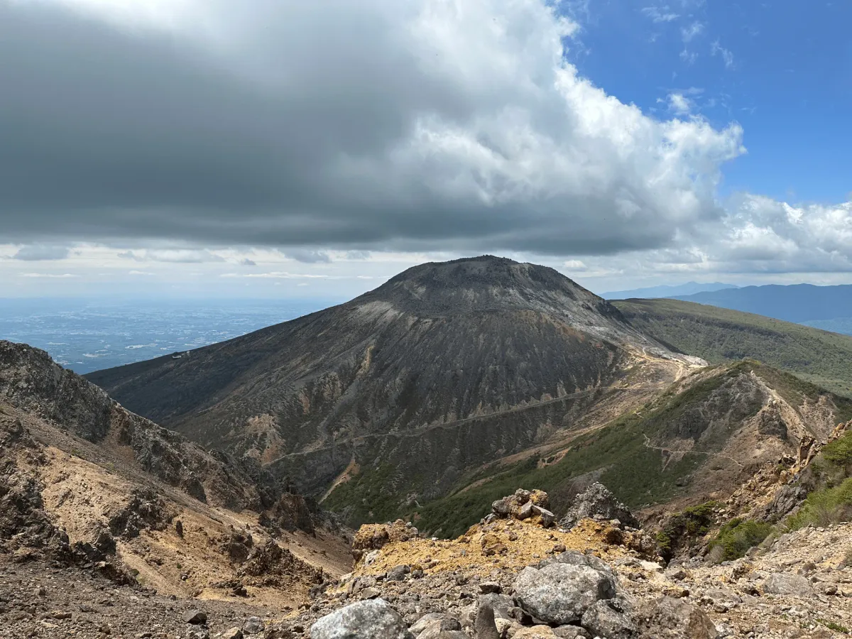
Mt Chausu (茶臼岳, Chausu-dake) is one of the major peaks in the Nasu mountain range, a Hundred Famous Mountain located in Tochigi. Since it’s a volcano, it has a very harsh yet beautiful scenery that you don’t see in a lot of other Japanese mountains. This turned out to be one of my favourite mountains of 2023.
If you’re going via public transport, it is accessible from Tokyo as a day trip, but with the Shinkansen fare it does come out to be pretty pricey (near 15,000 yen). The mountain does have a ropeway that takes you quite near the summit of Mt Chausu, so it is very beginner-friendly as well. Depending on which course you choose, it can be as short as 2km. I opted to skip the ropeway, and also took a detour to Mt Asahi and Mt Sanbonyari, for a total course length of 12km.
Hiking Mt Chausu: a quick summary
About 2.5 hours from Tokyo via Shinkansen to Nasushiobara station, then a 70 minute local bus to the trailhead.
- Mt Chausu (via ropeway)easyShinkansen + Bus1.5 hrs·2.1 km·↑ 235m
- Out-and-back via Mt Asahi and Mt SanbonyarihardShinkansen + Bus6.5 hrs·12.6 km·↑ 1018m


The trail starts off amongst the trees, but you’ll quickly leave this tree cover and everything will become very rocky and orange. I went at the end of May, which felt like the perfect time to go. I imagine the direct sunlight in the summer months can be pretty brutal.

Mt Chausu is actually quite close to the start of the trailhead, but the course I took involved first taking a detour out to Mt Asahi (朝日岳, Asahi-dake) and Mt Sanbonyari (三本槍岳, Sanbonyari-dake) before retracing my steps back to Mt Chausu.

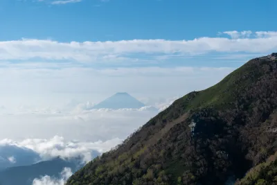
As you walk towards Asahi-dake you’ll be heading in the opposite direction to Mt Chausu, but all you have to do is turn around and Mt Chausu will be right there in the distance.


There were quite a few dogs I saw along this hike, which I found a little surprising considering how there are some narrow bits - I would have thought it would be a bit scary for a dog. On the other hand, there are no steep climbs or ladders so in that sense it is dog-friendly.

Once you reach Mt Sanbonyari, it’s time to retrace your steps all the way back to Asahi-dake and then onto Mt Chausu.


The final ascent up to Mt Chausu was very rocky.


Mt Chausu is a volcano so you can do a loop around the top of its crater. If you want to descend via the ropeway, that is an option as it is quite close by, otherwise you can descend via the same route you climbed.


Hiking course options
This is an out-and-back course starting at the Nasudake trailhead (那須岳登山口 Nasu-dake Tozan-guchi).
Although the course I did was 12.6km, there’s a couple of shorter course options:
- Using the ropeway in both directions (2km, 1.5h)
- Not using the ropeway, and climbing only to Mt Chausu (5km, 3h)
- Only taking the ropeway on the way up, going to Mt Chausu and then Asahi-dake, before descending (6km, 3.5h)
The route between Mt Chausu and Asahi-dake is the best part of the course, so I definitely recommend prioritising the third course I linked if you have the time and stamina.
There are toilets available inside of the ropeway building.
The quickest way up, using the ropeway in both directions. A good option if you want to see Mt Chausu without committing to a full day of hiking.
Skips the ropeway and climbs only to Mt Chausu, without the detour out to Asahi-dake and Sanbonyari.
When to hike Mt Chausu
Mt Chausu can be hiked between mid-May and November.
The buses to the trailhead run from the beginning of April through to the end of November. However there will still be snow remaining in April. By early May most of it will have completely melted, so it may be worth double-checking the trail photos on YAMAP to see the conditions if you are planning an early May hike.
Public transport access
You can get to Nasushiobara station via a Shinkansen from Tokyo. If you wanted to save money, it’s actually possible to take the local train up as well, which costs only 2600 yen but will take you 3 hours.
| Time | Location | Transport | Cost | |
|---|---|---|---|---|
| 06:20 | Tokyo station (東京駅) | Shinkansen | 6020 | |
| 07:31 | Nasushiobara Station (那須塩原駅) | |||
| 07:45 | Nasushiobara Station West exit (那須塩原駅西口) | Bus | 1430 | |
| 08:55 | Nasu Ropeway (那須ロープウェイ) |
From Nasushiobara station, there is a local bus that takes you up to the trailhead (it will take about 70 minutes). You can look at the latest timings for the bus to the trailhead on Navitime.
Looking at the 2023 schedule, the buses ran from the beginning of April through to the end of November, so I recommend double-checking that the bus is running before your trip.
Since the hike starts and ends at the same location, you can take a similar route in reverse back. Make sure to keep an eye on the final return bus time, which will be sometime between 3 and 4pm.
| Time | Location | Transport | Cost | |
|---|---|---|---|---|
| 15:13 | Nasu Ropeway | Bus | ||
| 16:30 | Nasushiobara | 1430 | ||
| 17:03 | Nasushiobara station | Shinkansen | 6020 | |
| 18:16 | Tokyo station | |||
| Trip total: | 14900 |
Car access details
There is a pretty decently sized free carpark at the trailhead called Toge no chaya. It’s a 2.5 hour drive from Tokyo.

Read more
Comments
Nice write up and great job with all your other postings.
Putting my pedant’s hat on I believe Sanbonyari is ever so slightly higher than Chausu.
Thanks Iain! Zooming in and looking at the photos I took of the peak markers... you are right on that one! Will update the post, thankyou :)
Leave a comment