
Mt Iwadono (岩殿山, iwadono-yama) is a mountain overlooking the city of Otsuki in Yamanashi. The hike conveniently starts at Otsuki station, and can either be done as a short hike to the summit and back, or you can opt for a longer 4.5h loop course, which comes with a short chain-climbing section and a thrilling walk along a rounded cliff.
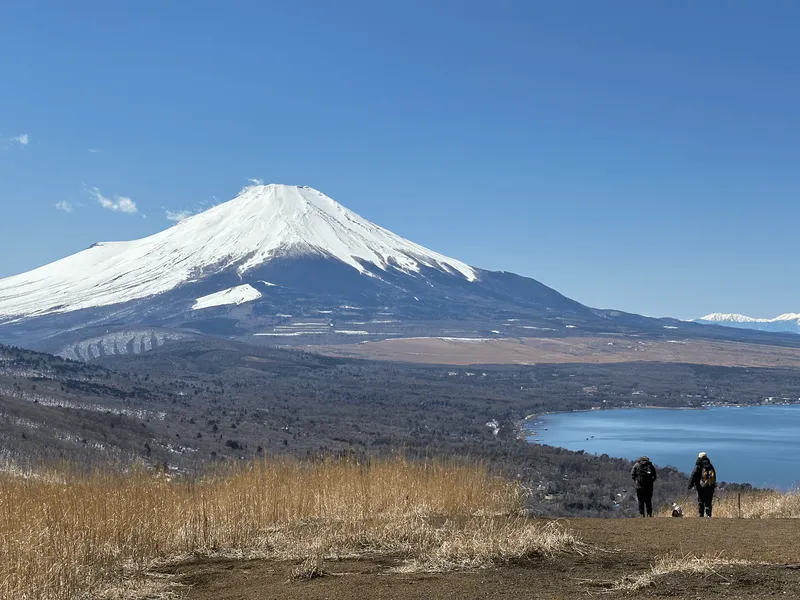
If you’re lucky, you can get a view of Mt Fuji from partway up the trail, and it’s particularly beautiful if you can time your hike to coincide with the blooming of the cherry blossoms in late March to early April.
Hiking Mt Iwadono: a quick summary
About 100 minutes from Shinjuku station to Otsuki station via the JR Chuo line (transfer at Takao station). Alternatively, 65 minutes via the Azusa limited express train if you don't mind paying extra for the fare.
- Out-and-back to Mt Iwadono easy Train2 hrs · 4.5 km · ↑ 315m
- Loop course via Maruyama Koen medium Train4.25 hrs · 7.1 km · ↑ 639m
It was quite a rainy start to April this year, but there was just one day of sunshine in amongst all the rain, and it seemed like the cherry blossoms were timed to be perfectly in full bloom too, so I had some luck on my side!

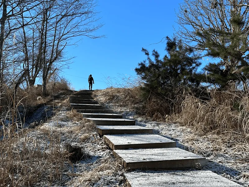
The hike starts at Otsuki station - if you take a look behind the station building, you can see the peak of Mt Iwadono in the distance. Even though I hiked on a Friday, thanks to the cherry blossoms being in full bloom, there were plenty of other hikers getting ready to set out as well.

Leaving the station, you’ll pass through the town and head over the train tracks, and then across a bridge.

The first stop on your hike will be Maruyama Park (丸山公園) which has its entrance along the side of the road.

And if the weather is on your side, this is your first opportunity to get a glimpse of Mt Fuji just peeking his head up above the buildings.

As you climb up to the park, you’ll start to be able to get a much better view.


Maruyama Park has a traditional-style wooden building. To be honest I had just assumed it was some sort of shrine, but when I googled it later, I realised it’s actually a community centre (the 岩殿山ふれあいの館) which houses a small photography exhibit.


The cherry blossoms here were in full bloom - for reference I hiked this mountain on the 3rd of April 2026, although the exact blooming times can vary year on year.


I forgot to take a photo today, but if you look up behind the building, you can see up to the peak of Mt Iwadono as well.

Heading to the left and behind the community centre, you can continue your hike up to Mt Iwadono.


This shortcut path only reopened last December, so it’s quite new. Prior to that, you had to head back down to the main road, and do a detour around to a different trailhead.

There were even a couple of bells attached to ropes on the trail - probably for bears.

Eventually you’ll come to a fork in the path. The left trail goes to the spookily named “Child-Dropping” (稚児落とし or chigo-otoshi) while the right path goes to Mt Iwadono.


After about 60 - 90 minutes of hiking, you’ll come to the peak of Mt Iwadono. For a fun history fact, there was once a Iwadono Castle here at the peak in the 16th century, although there is no longer any traces of it remaining.

And actually, this isn’t even the “real” peak - that’s a little bit further along. It’s quite easy to assume this is the real peak if you look at this peak marker, unless you notice the little arrow in the top corner that points you onwards.

From this fake peak though, you can get a another nice of Mt Fuji. There’s also a small field of sakura trees which is a nice spot to take a picnic.

I think maybe I was a bit too early for the blooming of these sakura trees near the summit - but I can see that by the 11th of April they had completely finished blooming so it must be quite a short timeframe to catch it in full bloom.

There was one rhododendron tree that was blooming with some pretty purple flowers, at least!

If you head a little bit onwards, you’ll reach the actual peak of Mt Iwadono.

There’s the same brown peak marker here, marking Mt Iwadono as one of “Otsuki’s 12 views of Mt Fuji” plus a wooden pole marking it as one of the 100 Famous Mountains of Yamanashi.

If you happened to climb up here using the loop route (and skipped Maruyama Park), you would reach this peak first, before continuing onto the “fake” peak. Whichever way you came from though, you’ll head back to the junction point between Mt Iwadono and chigo-otoshi.

If you just wanted to do a quick hike, you can head back down to the park and main road from here. Otherwise, continue along the trail towards chigo-otoshi.

The trail suddenly got a lot quieter beyond this point, as I’m sure some people just take the shortest route to Mt Iwadono and back.
People can leave location-based comments on YAMAP, and as I was walking and scrolling the map, I noticed someone had commented they had seen a bear (!) only a week earlier on the trail. This is what prompted me to write a separate post recently on if you should be scared of bears when hiking in Japan - the short answer is no, but it can still feel a bit spooky on the trail, especially if it’s super quiet.

Luckily as I kept going on the trail I passed by a couple people which reassured me a bit.

Mt Iwadono has two short sections where you have to climb/descend with a rope, so a pair of gloves can come in handy here. It seems like this first section you can possibly go around via a “forest route” but the path looked a bit overgrown so I decided to just stick with the rope path.


The second spot is a bit of a tricky descent, that comes with some rope to help you out.

You just have to take it slowly and make sure you’ve got a good foothold as you go down.

Once you’re past this, you can climb up to a view point where you can see back towards Mt Iwadono.


Then the next peak of the day is Mt Tenjin (天神山). The peak marker itself is rather unassuming and in the forest, but just beyond that is a small clearing.

If you keep your eyes peeled around here, apparently there is a spot where you can see the test track for the maglev train. I couldn’t actually figure out where the track is exactly - but a lady sitting down exclaimed to her friend that she had seen it zooming by (it goes at speeds of up to 500km/h, so you have to be paying close attention!)

This can be a good spot for a quick lunch break if you are hungry, but the views are better from “child’s drop” if you continue along for another 20 minutes.

Chigo-otoshi or “child’s drop” is an exposed, rounded cliff-face that you can walk alongside.

You can inch closer to the edge if you dare, but really the path is quite wide so you never really feel in any danger of slipping. It’s quite an odd name to see on a mountain so I was curious how it got its name.
I came across this article which explains that after the fall of Iwadono Castle, the Lord of the castle surrendered but his concubine, Chidori-hime, fled with their children. When one of the children - still an infant - began to cry, one of her attendants flung the child off the cliff in order to evade detection.

Quite a grim story if it’s true. As you continue along the cliff-face, you’ll reach its highest point, where you can get a pretty good view of the course you’ve walked along. As I mentioned before, this is a pretty good place for a lunch break to enjoy the views.

With the cliff-walking over, finally it’s all just descent back to Otsuki train station.


The one exciting part on my descent was when I spotted a snake.

I think a Japanese rat snake. Luckily it’s quite rare to see snakes on hikes. I’ve spotted the mamushi two or three times, which is more scary as it’s venomous, but the rat snake is harmless and rather cute.

The end of the hiking course will come into view with a junction point. Confusingly, both signs point to Otsuki station (大月駅).

But helpfully someone has marked with a pen that the left-hand course is a short cut (even in English, too).

Once off the trail, the walk back to the station takes another 30 - 40 minutes. You do have to pass underneath a highway bridge, but otherwise it’s a rather peaceful walk through a residential area.


Eventually you’ll cross a bridge over the train tracks, and make it back to Otsuki station.

Just before the station, I could hear a bird trilling on a balcony - and I spotted a male blue rock thrush! The first and only time I had sighted one of these guys was a female, whose colouring isn’t nearly as exciting as the male’s, so this was pretty neat.

Back at Otsuki station, I managed to hop on a train that took me directly back to Shinjuku station - no transfers required - which was a comfortable way to end my day out.

Alternatively if you have some time to spare, Otsuki station is large enough that there are a number of food options - including the Tsuki Cafe.

Hiking course options
The shortest possible course is from Otsuki station via Maruyama Park, if you just want to hit the peak and then head back down. If you have a car, there’s a carpark near Maruyama Park which shortens this hike even further to only 2.8km total.
The trail along this section is beginner-friendly and fairly straightforward.
Note the YAMAP course linked is for the full loop, but basically you would follow the course up to the peak, and then retrace your steps back to Otsuki station.
This trail newly reopened in December of 2025. From Otsuki station, you head up to Maruyama Park, and then the shortcut path up to Mt Iwadono. After you reach Mt Iwadono, you will have to retrace your steps a bit, and then head towards chigo-otoshi, and then descend back down to Otsuki station.
In the area between Iwadono and Yoji-otohsi, there is one short ladder/chain-climbing section, plus a short descent over a rocky/tree-rooty bit that is made easier with the help of a rope. Both I think are still doable for near-beginners, but just something to keep in mind.
Note the last 45 minutes of the course is along a road. It seems you could even call a taxi like this person did which costs about 2200 yen back to Otsuki station.
The regular loop course, skipping the Maruyama Park shortcut. In this case, you can head up to Maruyama for a brief detour if you like, but then head back down to the main road and keep walking along it for a while until you come to the Hatagura trailhead (畑倉登山口).
Most of the trail is the same - the one upside is that this is a “true” loop course that doesn’t require any doubling-back, but I would just go via the Maruyama Park course if you are coming during cherry blossom season.
The Alltrails course I have linked is a fair bit longer (16km) but was the only one I could find - I would recommend using YAMAP if you can, or you can start on the AllTrails one and then once you are past chigo-otoshi, take the direct route back to the station.
Public transport access
Your hike to Mt Iwadono starts at Otsuki station (大月駅), which is accessible via train from Shinjuku station. You have two options:
- Take a Takao-bound train on the JR Chuo line to Takao station (高尾駅). Then transfer to a local train to Otsuki station. This will take 100min and cost 1400 yen.
- Get an Azusa or Fuji Excursion limited express train, which takes only 65 minutes directly to Otsuki station. The downside is it costs 2400 yen, and you’ll also have to reserve a ticket in advance.
I usually opt for the regular train and transfer at Takao station. Transferring at Takao is quite easy (usually the train is on the same platform).
On weekends, it can be hard to get a seat on the train from Takao as lots of people will do the same transfer between trains as you. One hack would be to get to Takao station slightly earlier, which greatly increases your chances of getting a seat.
Otsuki station is a transfer point for people heading to the Mt Fuji area, so it is quite lively. It can be hard to book last-minute tickets on the express train, especially when heading home, as the train fills up with tourists heading back from the Fuji area - something to keep in mind.
Car access details
Most people hike Mt Iwadono by train, but there is a free carpark located near the entrance to Maruyama Park (岩殿山公園 市営駐車場) which has 11 car spots.
When to hike Mt Iwadono
With a max elevation of 634m, Mt Iwadono can be hiked in the winter months without any problems - taking a quick look at YAMAP logs at the end of January and February there doesn’t seem to be any snow on the trail.
As with all low-elevation mountains however, although you could technically hike it year-round, I don’t generally recommend it in the summer months due to how hot it gets (and the bugs, too). Another notable drawcard of Mt Iwadono is its Mt Fuji view, and your likelihood of being able to see Mt Fuji is higher in the colder months.
So for those two reasons combined, I would recommend climbing Mt Iwadono between November and May.
Catching the cherry blossoms at Mt Iwadono
If you are looking for a cherry blossom forecast for Mt Iwadono, I would recommmend looking at walkerplus and weathernews, which provide info on when the cherry blossoms are estimated to bloom for Maruyama Koen (that area near the start of the trail).
For reference, I hiked it on April 1 2023 and April 3 2026 and both times were about in full bloom, although I think the 2023 time was a bit prettier. It was quite rainy this year, which complicated things as you have to hope the rain doesn’t make the petals start to fall off, and also you need to snag a sunny day at full bloom time in amongst all of the rain.
You can also check out the photos on the latest trail activity on YAMAP before you hike to get a good idea of the current blooming state of the cherry blossoms.

Read more
Recent posts
 hikes
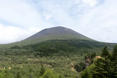
hikesMt Asama (Mt Maekake): hiking Karuizawa's active volcano
31 May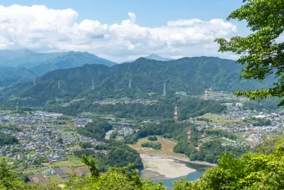 hikes
hikesMinami-Takao Seven Summits hike
26 May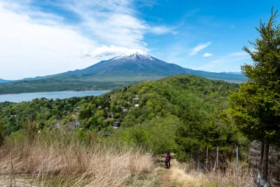 hikes
hikesMt Ishiwari, Mt Hirao and Mt Ohira: Lake Yamanakako hike
17 May
Comments
Leave a comment