Mt Kumotori (雲取山, Kumotori-yama) is the highest mountain in Tokyo at an elevation of 2017m. Due to its 20km course, it’s most commonly done as a 2-day hike with a stay at the summit. But for those who are up for the challenge, it’s also possible to do as a day hike, which is what I did in June of 2023.
Mt Kumotori straddles three prefectures - Tokyo, Saitama and Yamanashi - and has trailheads on both the Tokyo side (Kosode trailhead) and the Saitama side (Mitsumine Shrine). Starting from either trailhead is roughly the same distance, but hiking from the Tokyo side tends to be the more popular option and has better access via public transport, so is the course that I hiked. A fun route might be to start at one trailhead and end at the other (I will have to try that one day).
Although the trail is long, it’s a relatively smooth incline with 1700m of elevation gain, and there aren’t really any tricky bits. There is a slightly steeper stretch closer to the summit. For those looking to practice longer trails and/or spending the night at the summit, I would say that this is a great beginner-friendly option for that.
As a fun fact for anime-lovers, Mt Kumotori is also said to have inspired the home of the protagonist Tanjiro of Demon Slayer (Kimetsu no Yaiba)! The first two episodes have Tanjiro hike up and down a mountain - which is Mt Kumotori itself.
Update 26th of May 2026: On the 19th of May the lower half of a hiker’s body was found in Okutama, possibly due to a bear attack, plus a separate person was attacked while hiking on the 17th (see news report). This wasn’t on the trail for Mt Kumotori itself, and so at this time hiking Mt Kumotori via the standard route is still possible. Note that if you are considering any alternative routes in and around the Okutama area, some sections of the trail may be closed off so I would recommend doing your research beforehand.
The town of Okutama also currently advises hikers to bring a bear ball and/or radio to alert bears to your presence, so for peace-of-mind it may be worth bringing that along (or hiking in a group).
Hiking Mt Kumotori: a quick summary
About 3 hours from Tokyo. Take the JR Chuo line to Okutama station, then a 30-min trip on the local bus to either the Tozura (留浦) or Kamosawa (鴨沢) bus stops near the trailhead.
- Out-and-back from Kosode trailhead (Tokyo side)hardTrain + Bus10.75 hrs·19.7 km·↑ 1700m
- Out-and-back from Mitsumine Shrine (Saitama side)hardTrain + Bus11.75 hrs·18.3 km·↑ 1868m
Mt Kumotori has decent public transport access, with buses running from Okutama station to near the trailhead. In my case, I set out from home just before 5am, and was able to start my hike from Tozura (留浦) bus stop around 8:15am.

From Tozura, it’s a 2.8km, 50 minute walk to the actual trailhead (where the carpark is). I hiked in June, which is when the rainy season begins in Tokyo, so I was a bit worried about the weather. But luckily the forecast for this day was rain only in the early morning, so by the time I began my hike there were clear blue skies.
Just before 9am I arrived at the Kosode trailhead (小袖登山口) where you begin the actual hike.

The carpark at the trailhead was quite empty, and I wonder if the reason was due to the weather forecast, or the fact that it was a weekday. I was alone for most of the trail, except near the summit where I passed some people descending.

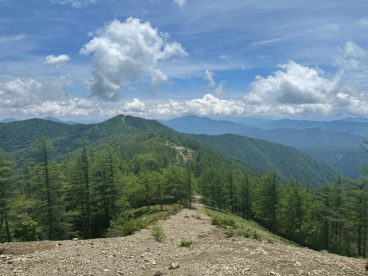
There is a total 1700m elevation gain over this course, but considering that it’s spread out over 20km it didn’t feel too steep overall. It’s also quite walkable, with long stretches of “smooth” path rather than any tricky sections with lots of tree roots or rocks to trip you up on.

This course also takes you past Mt Nanatsuishi (七ツ石山, Nanatsuishi-yama) which has an elevation of elevation 1757m.

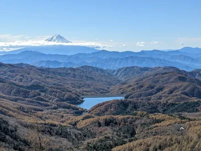
From Mt Nanatsuishi you get your first glimpse of the peak of Mt Kumotori in the distance.


As I look back at the progress I’ve made, I can see a large peak in the front, which I would guess is Mt Nanatsuishi.

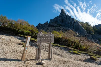
Once you begin the final approach, you can see a large building which is the mountain hut at the summit of Mt Kumotori.


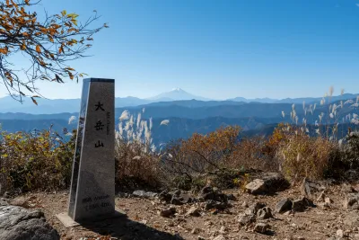
Once you reach the summit, there’s a couple of different peak markers, since Mt Kumotori is famous for three different things:
- It’s the highest mountain in Tokyo prefecture.
- Also it’s one of the Hundred Famous Mountains of Japan.
- And finally, it’s a Hundred Famous Mountain of Yamanashi.


From here it’s back down the same way I came. Before I started this hike I was pretty concerned about whether I could reach my time deadline (to make sure I got on a bus before it got dark) but I was ahead of schedule by this point, and feeling pretty good.

In the end I finished my hike just after 3pm. Including the walk from the trailhead to the bus stop, I walked a total of 24km in just under 7 hours.
Hiking course options
The Kosode trailhead (小袖登山口 Kosode-tozanguchi) is the most popular trailhead from which to hike Mt Kumotori. The course is an out-and-back that starts and ends at the trailhead’s carpark. Note that the course stats - 19.7km and 10.75 hours - only accounts from starting at the Kosode trailhead itself. If you’re coming on public transport via the Tozura or Kamosawa bus stops, you’ll have to walk an extra 45 minutes one way from the bus stop to here, bringing the total course time up to over 12 hours and total distance to around 24km.
Although the trail itself is well signposted, it may be a bit harder to head to the trailhead from the bus stop, so I recommend having a GPS map handy.
There is a toilet available near the bus stop, as well as at the peak.
An alternative approach is from the Saitama side, starting and ending at the Mitsumine Shrine (三峯神社) in Saitama prefecture. However it does seem like public transport access is not available as early in the morning on the Saitama side, and the last bus of the day is before 5pm, so this is probably not advisable as a day-hike in that case.
A third course option would be to start and end at different trailheads - I couldn’t find an official YAMAP course for this one, but here is one activity log of someone starting at Kosode and ending at Mitsumine Shrine.
Public transport access
Access to Mt Kumotori is first via a train on the JR Chuo line to Okutama station. I recommend using Google Maps or a train app of some sort, as you will have to make at least one transfer to get on the JR Ome line, probably from Tachikawa station.
Once you exit the train station, the bus is directly across the road - you won’t miss it.
From here you have two bus options:
- the 奥11 bus to Tozura (留浦) bus stop
- the 奥10 bus to Kamosawa (鴨沢) bus stop
From either bus route, you will then need to walk about 2.5km (45mins) up a hill to get to the Kosode trailhead.
The bus you will choose just depends on the morning timetable and which one you are able to feasibly get. The reason I went for Tozura personally was that the earliest I could get to Okutama station was 7:17am, and the buses to Kamosawa were leaving at 7am or 8:45am. In comparison, the bus to Tozura was leaving at 07:25 so I was able to make the connectinon.
Also when I climbed this on a weekday, there was only one other person that got off at the same bus stop as me, so I wouldn’t get too nervous if you are the only one - it may be a bit quiet on weekdays. There are many other mountains and trailheads in the Okutama region, so you may start off with other hikers on the bus as well before they get off at various points along the way.
If you really wanted to do this as a day hike but were a bit worried about the timings, one option would be to sleep the night before at Okutama station or somewhere nearby, and then get the earliest bus to Kamosawa from Okutama station (which leaves at 5:34 on weekdays or 06:05 on weekends).
Please note the schedule I followed is not doable if you follow the official course time. I wouldn’t recommend doing this as a day hike unless you are confident in being able to do this course quickly. If you weren’t sure but wanted to give it a go, I would recommend keeping an eye on the time and turning back if you don’t think you’ll be able to make it off the trail before it gets dark. As you pass Mt Nanatsuishi on the way, you could consider this as a good turning back point.
For the latest on bus schedules, I would recommend Googling “奥多摩駅 ~ 留浦” (i.e. “Okutama station ~ Tozura”) which should bring up the NAVITIME timetable (always accurate) and also the timetable for all buses leaving from Okutama station.
Make sure to note the daylight hours during your hike so that you can finish while it is still light outside. The very last bus back from Tozura is at 19:19, but I would not recommend hiking this late - in summer you should definitely at least aim for the 17:57 bus,
Note that finishing by 6pm may be reasonable in summer, but it gets completely dark by 5pm in wintertime.
For the latest on bus schedules, I would recommend Googling “奥多摩駅 ~ 留浦” which should bring up the NAVITIME timetable.
Car access details
| Car park | Time (from Tokyo) | Round trip cost |
|---|---|---|
| Tabayama-mura Sonei carpark (丹波山村 村営駐車場) | 2h | ~1700 yen |
The carpark is at the Kosode trailhead (小袖登山口). It seems to be decently sized, although not huge. It was relatively empty when I went on a weekday morning.
Staying overnight at the summit mountain hut
There is one mountain hut available at the summit of Mt Kumotori. It’s called Kumotori Sanso (雲取山荘) and is open year-round. I have a separate guide up on what it’s like to stay at a Japanese mountain hut if you are curious.
If you’re staying in the hut, they have reservation details on this page. You can call them in Japanese, but luckily it seems they also accept reservations via email. You can also camp in your tent, which does not require a prior reservation.
One of the highlights of staying at the hut might be your opportunity to get an early morning Fuji view, if you are lucky. There is a SeeMtFuji forecast which I find to be quite reliable when hiking generally.
As a final fun fact, I learned from this blog post that the hut has a photo of the then Crown Prince Naruhito (now Emperor of Japan) and his wife Masako, who hiked Mt Kumotori in 1995. If you are curious, there are quite a few cute photos of the two on Getty Images.
When to hike Mt Kumotori
If you’re looking to hike Mt Kumotori without snow, you can hike between April and December. Looking at YAMAP, it seems like May is the most popular month to climb, as you can see the fresh green vegetation sprouting after the winter (known as shinryoku or “new green”). If you’re looking to climb in summer, the elevation at the peak is around 2000m which is reasonable, but probably still quite hot so I would be careful to bring lots of water. There is a fair bit of tree cover on the trail which should help keep you cool.
As snowfall can vary year on year, I would recommend checking YAMAP to see the conditions before you climb.

Read more
See other hikes nearby
Comments
This is so informative. I'll be hiking this next week and wanna do an almost identical route to you. From what station in Tokyo do I get on and what line? Then where do I get off from to get the bus to Tozura?
Thank you so much!
Luke
Hey Luke! You'll be able to get a train from Tokyo station on the JR Chuo line, and go all the way to Okutama station. It's not a direct train, so you'll need to make one or two transfers to get onto the JR Ome line, but the train platforms shouldn't be too far from each other. I recommend using Google Maps to get the exact schedule since it varies. Once you get off at Okutama, the bus stop is right across the road from the station.
This is so helpful and informative, thank you!
Thanks this is so well explained and helpful!
Thank you for your advice. I discovered this mountain thanks to your article and went yesterday. 24 KM from Kamosawa bus (9am), head to the up Kumotori and back to the bus station for the 2:30pm bus. Total 5 hours 15 minutes.
Hi Emma, can you give any advice about bears on mountains like this? I was planning to hike this mountain when I visit but my Japanese friend has told me not to because of bears. I saw that you posted an update in the article but I am not sure whether this is a serious issue. Do you do anything to prepare when you go hiking?
Hi Victor! So for sure one hiker was attacked by a bear - he was walking along the trail and saw it in the bushes, it ran up to him, swiped him with its claws twice, and then ran away. The hiker received serious wounds to his face and arm (as he defended himself). I would guess that the bear was startled by the human's presence, rather than it deliberately set out to attack the human. There was then quite big news about the possibility of a man-eating bear in Okutama (with the appearance of a body), but we don't really know if the hiker was killed and then eaten by the bear, or if the bear happened upon a corpse and ate it, or whether it wasn't a bear at all. Unfortunately it seems like news outlets / the police haven't really released any further information on what actually happened. Either way though, both incidents were in the Okutama area but not on the trail to Mt Kumotori itself.
It's hard to say whether you should or shouldn't hike Mt Kumotori. Personally, I had plans to hike another Okutama mountain (Mt Takanosu) recently but I decided to not hike it, since that is a more remote mountain. Mt Kumotori is still the most popular mountain in Okutama so I think it is safer (the more people around = less chance of bears). And there are still people climbing Mt Kumotori, I don't think the bear news has completely scared everyone off.
You could change your plans and find another non-Okutama mountain to hike - there are plenty of mountains in Tokyo! If you were to still hike it though, the first thing I would choose to do is hike it on a weekend with good weather, when the number of hikers on the trail will be higher. Out of an abundance of caution, you could also bring along bear spray, which you can rent from a Mont Bell store. Many Japanese also wear bear bells, which there isn't conclusive scientific evidence that it is useful, but you can also buy one of those as well.
I think if you bring along bear spray, and hike on a weekend, that's fair enough precautions to take and I would be comfortable hiking. Personally I have never hiked with bear spray before, and would probably still do the Mt Kumotori hike without bear spray, but I think it's hard for me to recommend that to someone else (as I have chosen to take on that risk myself).
Leave a comment