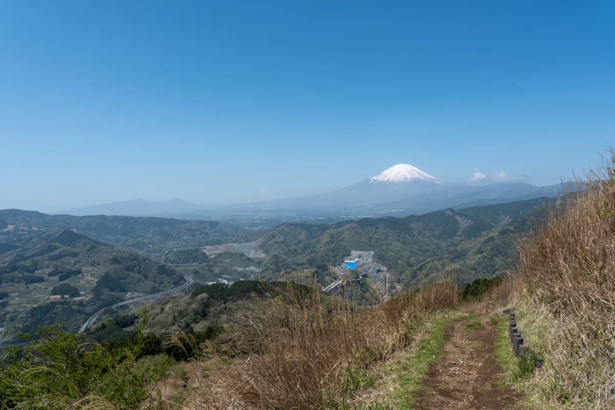
Mt Ono (大野山, oono-yama) is a 723m elevation mountain in Kanagawa prefecture, known for its views of Mt Fuji. The trail is public transport-friendly as it starts and ends at a train station, and the trail is fairly walkable, even passing by a field of grazing cows along the way.
Japan has so many mountains that I usually go to a new one each time I go hiking. But now 4 years in, I’m finding myself starting to revisit some of my favourites over the years, especially the ones that I hiked before I started writing on this blog. Mt Ono is one of those - I had a good impression of it from the last time I visited (even though I barely got to see Mt Fuji) so I’m glad I got to return on such a beautiful, sunny day.
Hiking Mt Ono: a quick summary
A 2-hour train trip from Tokyo to Yaga station on the Gotemba line.
- Out-and-back from Yaga station easy Train3.5 hrs · 8 km · ↑ 600m
- Yaga station → Yamakita station medium Train4 hrs · 10 km · ↑ 672m

The hike begins at Yaga station, which is a tiny rural stop on the Gotemba line. I would have taken a photo of it, but it was actually pretty packed with people. We arrived on the 9am train, which is a pretty ideal time to start a hike, so it seemed a lot of other people had the exact same idea as us.

Heading up the road from the station, you’ll cross over onto the other side of the train tracks, and then cut through a rice field.

After the rice fields, you’ll come to a bridge. Amusingly (or scarily?) the bridge has a “max 10 people at a time” sign at its entrance. I would recommend spacing yourself out if you’re coming in a larger group.

The first 30 minutes of your hike will be up a winding road, but as you gain in elevation you’ll also get your first glimpse of Mount Fuji.


Eventually you’ll come to a fork in the road where there is the trailhead for Mt Ono’s hiking course.

Overall the trail is quite pleasant to walk on (smooth paths, no tree roots) but it does have a total 600m of elevation gain, so be prepared for a proper hike.

The trail up also has a couple of deer fences. So if you come to a gate, just make sure to close it shut behind you.

Rather charmingly, some of the signposts have had their stumps painted with faces on them. And others have wood carvings that are starting to look rather weathered.


As we passed a rest spot, we noticed that some enterprising locals had set up boxes where you can buy some jam or garlic paste.

The blooming season for the cherry blossoms was already over, but there was one late-blooming variety of cherry blossom (known as the yae-zakura) on the trail.


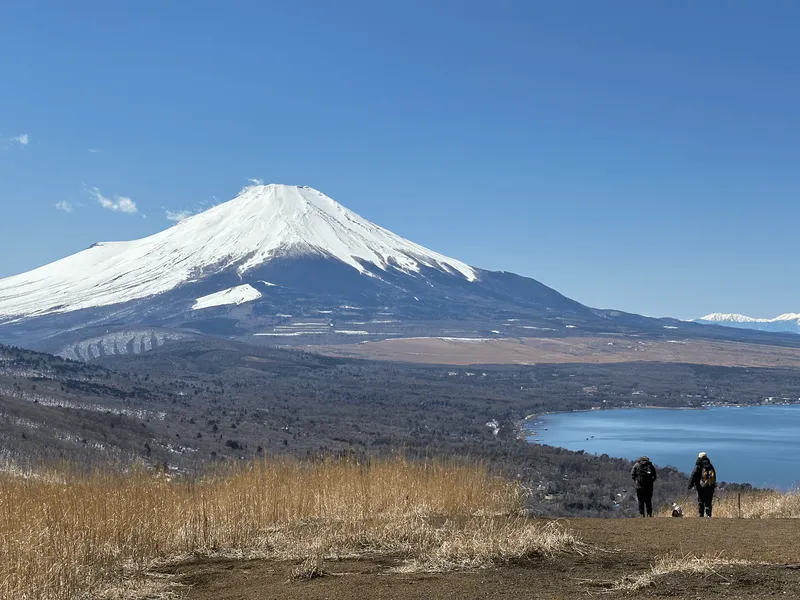
And as you keep climbing, Mt Fuji will again come into view. This is for sure the prettiest part of the course.

Plus a bench with a rabbit that informs you that you have reached the height of the Tokyo Skytree (i.e. 634m).

We hiked this in mid-April, which turned out to be a really warm day with a top temperature of 25°C in Tokyo (and a quick glance at the weather app on my phone put the local area here at 20°C). Actually it was on the verge of feeling hot, so I think if you were to climb this any later in the year you would want to make sure you are not starting too late in the day, due to the lack of tree cover.


At the summit, you’ll be greeted by a couple more carved wooden statues - a duck, a deer looking at its butt, plus a bunny.

And I had thought the hanami (flower viewing) season was over, but we were just in time for the blooming of this sakura tree.


It seems to be the fittingly-named yama-zakura (山桜 or “mountain sakura”) variant.


From the peak, you can take the exact same route in reverse back down to Yaga station, but we opted to continue on for the slightly longer course down to the neighbouring Yamakita station.

Although it doesn’t really feel like it, Mt Ono is technically one of the mountains in the Tanzawa mountain range - and somewhere in the distance on the left are the peaks of Mt Tonodake and Mt Tanzawa.

Along with the Mt Fuji view, the other interesting point about this hike is that there are cows!

This is Kaoru-no-farm, which was started by a lady named Kaoru who made the news for starting up this dairy farm when she was just 29.


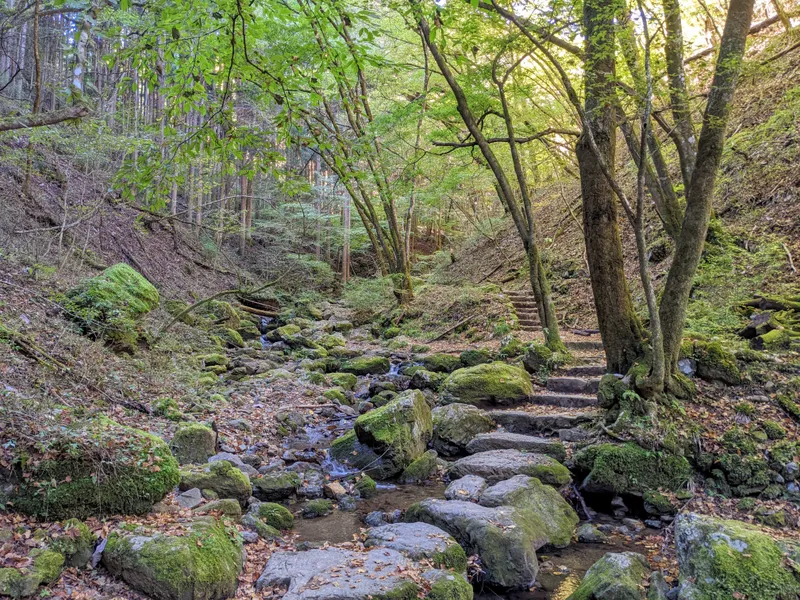
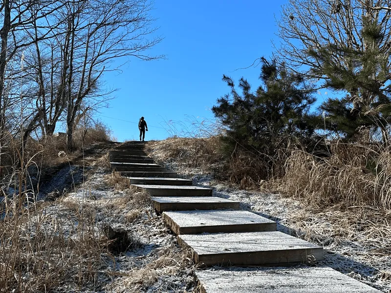
Once you head down a huge staircase past the field of cows, you’ll enter into a forested stretch.


On the hike up, we passed by a couple of large hiking groups. But in comparison this section of the hike was a lot quieter. I wonder if some people take the out-and-back course instead.

On the descent, the trail was a bit narrower and more like your typical hiking trail. One small section was slightly sloped, but if you watch your step you will be fine.

At one point we came to a little junction in the trail, complete with a pictograph.

Usually signs might have some Japanese on it which doesn’t always help, but this makes it pretty clear that there’s a detour Jizo statue up ahead.

And yep, there were two little tin sheds housing some Jizo statues.

My husband helpfully attempted to translate the story written on the wall of the shed - something about a child getting lost from his parents, stacking stones, being attacked by demons, and then being saved by the Jizo.

So after I got home I decided to read up on this - and it’s the story of Sai no Kawara (賽の河原). In Buddhist teachings, as part of your journey to the afterlife you must cross the Sanzu River (三途の川). However dying before your parents is considered to be a sin in Buddhism, so when children reach the river they are doomed to endlessly stack a tower of stones as a form of penance, which keep getting knocked down by some pesky demons.
Obviously this is a super sad story for any Buddhists out there that lose their children too soon - so the story has a bit of a happy ending where the Jizo Bosatsu comes along to act as their parent and escort them into the afterlife.
As another side note, I never really thought about why I often see Jizo statues on hikes and by the side of roads, but he is the guardian deity of children and of travellers, so that makes sense.

So, with that short lesson on Buddhism out of the way - back to the hike. Actually, the last hour of the hike is all along a road, which begins shortly after you pass the Jizo statues.


As you reach the first signs of civilisation, you’ll notice a tea field, and a former elementary school building. It looks a bit derelict but it has been re-purposed and is used by an NPO (共和のもり).


As you keep walking, you’ll pass two statues of ladies in horse-riding gear - randomly named Tanzawa Catherine and Christel. Even these two have some lore. They were originally located at the entrance to a riding club, which was coincidentally next to the trailhead for Mt Tonodake. Eventually they were given a fresh lick of paint and ended up here.

Just across from the pair, there’s a little capsule toy vending machine (or “gacha”). If you have a spare 100 yen, you can pop one in and get a pin badge.

After you finish passing through the residential area, you’ll have a long walk alongside a road.

The road feels like it stretches rather endlessly along here, albeit with one encouraging “20 minutes to go!” sign.

And once you make it into the town of Yamakita, you’ll pass along a side street that runs parallel to the railway track.

They had finished blooming, but we could see that this stretch of trees were actually all sakura trees. If you come a little earlier in the season, it would make for quite the view. We also spotted a woodpecker in the trees (alas, it flew away before I could get out my telephoto camera lens).

There’s also a cute cafe here that does pudding and soft serve. The pudding they serve comes from the farm that’s up near the peak of Mt Ono.

And as I approached Yamakita station I also saw a lot of barn swallows flying overhead. They never seem to sit still, but when one landed on a power line I took that opportunity to grab a photo for my birding collection.


Arriving at Yamakita station, our hike was done for the day.

The train from Yamakita station only runs once an hour so depending on how much time you have, you could kill time at the cafe or have a proper lunch at one of the restaurants in the area. There’s also a Daily Yamazaki convenience store if you want something that’s a bit quicker.
Hiking course options
The course we took. You can do this course in either direction, but the two reasons I would recommend doing it in the order that we did it in are:
- There are more opportunities to see Mt Fuji on the hike up, and generally your chances are higher of seeing Mt Fuji in the morning, so it’s best to do the climb via Yaga station first.
- Yamakita station is a lot more lively, and has some lunch / cafe options, plus an onsen (“Sakura no Yu”) so there’s a lot more to do post-hike. Yaga station is fairly dead in comparison.
The one reason I might do this one in the reverse is if Mt Fuji is not visible at all - then you could start from the Yamakita side in the hopes that as the day goes on, there might be an opportunity for the clouds to clear and Mt Fuji to pop out.
Starting at Yaga station, after reaching Mt Ono, you can retrace your steps back down the mountain to Yaga station. To be honest, this course is nearly the same difficulty as above. I would recommend this if you are looking for a slightly shorter hike, or if you want want the familiarity of knowing what the descent hike is going to look like beforehand (since you will have already climbed it).
Mt Ono is accessible by car, so if you are looking for a quick picnic at the summit, you can drive to a carpark that’s right near the top.
Public transport access
The hike starts at Yaga station (谷峨駅) on the Gotemba line. I would recommend looking at Google Maps to figure out the best route there.
If you are coming from Tokyo station, the quickest possible route is on the JR Tokaido Line to Kozu station (国府津駅) and then a transfer to the Gotemba line until you reach Yaga station.
If you are coming from Shinjuku, you should take a train on the Odakyu line to Shin-Matsuda station (新松田駅), and then transfer to the Gotemba line from there. The Odakyu and Gotemba lines are a short walk away from each other, and if you have the spare time there is also a convenience store at Shin-Matsudata station you can pop into.
The hike ends at Yamakita station. The train from Yamakita station only runs about once an hour so I would pay attention to the timings to make sure you can catch your intended train.
As a final pro-tip, when we got off the train at Yaga station there was a huge queue for the toilets.

Being a tiny rural station, there’s probably only 1 male and 1 female toilet each in the toilet block. If you have time and are going via Shin-Matsuda station, I might recommend using the toilets inside of Shin-Matsuda station (i.e. before you exit the barriers) since those are larger/cleaner.
Otherwise, there was at least one toilet partway on the hike up, and then one available at the summit as well.

Car access details
Mt Ono has a carpark near the summit which can fit a total of 40+ cars. It’s about a 2-hour drive from Tokyo. On the day we hiked it, although there were plenty of hikers about, the actual number of people using the carpark was very few so there were plenty of spots. You can find the carpark on Google Maps here.
When to hike Mt Ono
Mt Ono has an elevation of 723m, which makes it mostly snow-free throughout the year. I would recommend climbing it in the colder months as it makes for some rather comfortable hiking, and would avoid it in summer due to the heat and bugs.
In terms of snow, from a quick look at YAMAP it doesn’t seem like Mt Ono has a period where it is consistently covered in snow - just a couple days here and there during winter. As a reference point Tokyo had some snow on the 7 - 8th of February in 2026, so you can see there’s a fair accumulation of it up on Mt Ono from this YAMAP hiking log on the 9th of February. There also seemed to be a smattering of snow in mid-January which cleared up fairly quickly.
We hiked this in mid-April, which was the perfect time for the yama-zakura tree at the summit. If you time your hike for towards the end of March, you will be able to enjoy the sakura trees down at Yamakita station.
If you are unsure of the conditions, I would encourage you to take a look at the latest trail logs on YAMAP before your hike so you can verify what the trail looks like.
If you are wanting to catch Mt Fuji, make sure to take a look at the Mt Fuji visbility forecast before your hike.

Read more
Recent posts
 hikes
hikesMt Asama (Mt Maekake): hiking Karuizawa's active volcano
31 May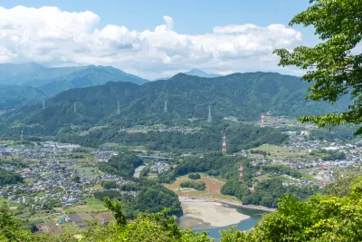 hikes
hikesMinami-Takao Seven Summits hike
26 May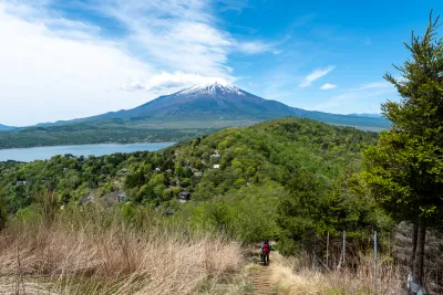 hikes
hikesMt Ishiwari, Mt Hirao and Mt Ohira: Lake Yamanakako hike
17 May
Comments
Leave a comment